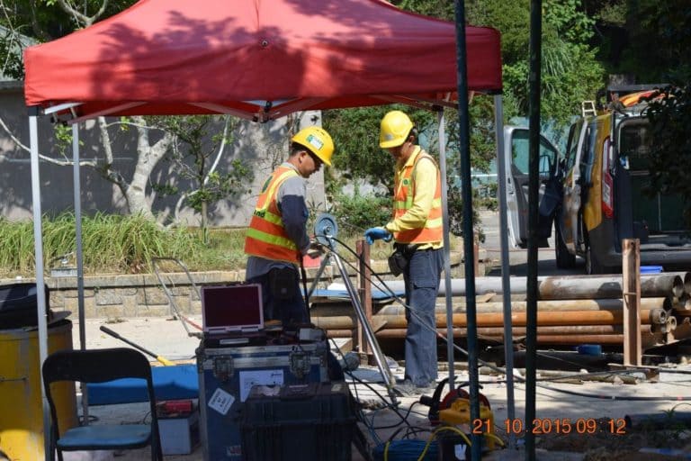
The problem we are solving is the lack of reliable geotechnical data in Cambodia's construction sector, which poses significant risks to project viability and safety. As the demand for infrastructure development increases, construction companies often face challenges related to groundwater management and soil stability. Without accurate geotechnical assessments, projects may encounter unforeseen complications, resulting in delays, increased costs, or even structural failures. Geotechnical Hub aims to address these issues by providing comprehensive drilling and testing services, ensuring that our clients have access to the critical information needed for informed decision-making and successful project execution.

Geophysical surveys have a wide range of applications that are crucial in various fields. In archaeology, these surveys play a vital role in detecting buried structures and artifacts without the need for invasive digging, thus ensuring the preservation of historical sites. In geological explorations, they are instrumental in identifying optimal locations for drilling and mineral extraction. Additionally, in civil engineering, geophysical surveys are essential for evaluating ground conditions to facilitate the construction of foundations, roadways, and other infrastructure projects.

### The Importance of Construction Control Processes in Project Success
By running comprehensive investigations, construction teams can successfully mitigate potential challenges that could otherwise jeopardize the timeline and budget of the project.
Site conditions can vary dramatically, which can pose unforeseen challenges if not adequately assessed. Through a thorough site investigation, construction teams can identify potential hazards or complications in advance.
The construction control process does not stop at soil testing and material selection. It extends into ongoing monitoring services across various industries, such as oil and gas, water, and subsea cable installations. These industries require specific protocols to manage the complexities of their environments.
Implementing a robust monitoring framework means construction teams can adapt to real-time challenges, making it easier to optimize project designs as conditions evolve.
A detailed site investigation coupled with thorough monitoring services helps identify potential environmental risks.
In conclusion, the construction process—anchored by rigorous site investigations and continuous monitoring—is integral to the success of any construction project.

Geotechnical Hub is a proposed enterprise based in Phnom Penh, Cambodia, specializing in groundwater and geotechnical services. The business will offer drilling and testing services for groundwater exploration, providing essential data for construction projects. In addition to these core services, Geotechnical Hub will monetize its operations by offering consultancy services to construction companies, guiding them through geotechnical analysis to ensure project viability and safety. Although the business is in the conceptual stage, the outlined strategies aim to establish a strong market presence, catering to the growing demand for reliable geotechnical data in Cambodia's expanding construction sector.

The identification and management of groundwater are pivotal elements in the development of a site. It is imperative to comprehend the groundwater table and the possible routes through which contaminants may migrate. This knowledge is fundamental for guaranteeing the environmental safety and sustainability of the site.
Groundsearch priorities high quality Project management. That includes involves a wide range of activities, such as investigation planning, budget management, reporting, and analysis. These activities are essential for ensuring the smooth and effective implementation of a project, while also staying within the project timeline and budget constraints.
Analyze Rock Base and Geotechnical data gathered from MASW Mapping down to depths of 100m or greater, allowing for the direct determination of soil stiffness and strength. Additionally, evaluate the potential for liquefaction and correlate the results with SPT/Drill Hole information and other pertinent site data.


EXPLORE WITH PRECISION
Groundsearch actively involved with multiple international minerals exploration programs in locations as diverse as Mongolia, Cambodia and Africa, as well as operations throughout ASia and the South Pacific
Groundsearch, we specialize in cutting-edge Exploration, geotechnical and groundwater investigations. Our advanced technological solutions enable us to explore for minerals efficiently and accurately, ensuring reliable results for our clients.

Two key concepts are Greenfield and Brownfield. A Greenfield exploration project refers to a brand new mineral targetdeveloped from scratch, not based on any existing systems or code. It's like building on a greenfield site, land that has yet to be developed. On the other hand, a Brownfield exploration project utilizes previously developed mineral resources, similar to redeveloping a brownfield site, land that has been built on before. Both types of projects have their unique risks, costs, and benefits.In the exploration phase of a project, methods such as auger, trenching, and pitting are used.

Trenching and test pitting allow for shallow exploration of easily excavated rock or soil materials, enabling visual inspection of strata. This is crucial in logging profiles and selecting samples. Pitting refers to the formation of small pits in a surface due to corrosion, a factor to consider during site development.


Detailed surveys and drill target generation are part of the reconnaissance and prospecting stages of a project. These stages generate resource data with clearly defined degrees of geological assurance, which is essential for the mineral extraction process that typically begins with the G4 stage.
In conclusion, project generation involves a series of steps from idea conception to detailed exploration and target generation. Whether it's a Greenfield or Brownfield project, each stage requires careful planning, execution, and monitoring to ensure successful outcomes. Groundsearch is expert at this planning and can show a great success record.


For general info on project management and consulting contact Grant Roberts:
Ph: +855 10 863111
Email: grant@groundsearch.biz
contact us on Facebook

Borehole geophysics has proven to be an indispensable tool for our clients in coal exploration, mineral mining, coal seam gas exploration and scientific research to name just a few. It is an incredible value-adding tool to confirm target depths, characterise overburden, assess dipping angles and much, much more.

Groundsearch uses state of the art combination tools from Century Geophysical Corporation to maximise the information gathered from the hole, while maintaining usability and the convenience to transport the equipment to operate from nearly anywhere (and over the years our clients have occasionally pushed this “anywhere” claim to extremes! – See “Our Projects”) Our most popular tools are listed here, but we can get in a tool to suit almost any endeavour very quickly.
With the backing of a huge amount of experience in exploration projects all over NZ, and a comprehensive support structure, we can manage your borehole geophysics effectively and efficiently. Email us for more information.
The Series 9239, Compensated Density logging tool uses the two focused density detectors to compute borehole compensated density real time while logging. No post processing required to produce CDL bulk density. Additionally, the tool also records natural gamma, caliper , medium guard resistivity, and borehole temperature.
The 9239 is a very well proven, diverse and reliable tool which is ideally suited for coal exploration as well as a variety of other applications. It delineates coal seams with fantastic accuracy, and can operate inside or outside the water column, and even inside or outside drill rods or casing.
The Acoustic Televiewer takes an oriented “picture” of the borehole using high-resolution sound waves. This acoustic picture is displayed in both amplitude and travel time. This information is used to detect bedding planes, fractures, and other hole anomalies without the need to have clear fluid filling the boreholes.
The televiewer digitizes 256 measurements around the borehole at each high-resolution sample interval (.005 meters/.02 feet). This data is oriented to North and displayed real-time while logging using the Visual Compu-Log software. Analysis includes color adjustment, fracture dip and strike determination, and classification of anomaly. It allows information to be displayed on the graphical screen, plot, and in report format. Optionally, the tool can be equipped with a natural gamma sensor.
The Full Wave Sonic tool contains a single transmitter and dual receiver to record formation travel times. The full wave form data is also recorded simultaneously, along with near and far travel times, borehole-compensated delta time, calculated sonic porosity, receiver gains, near/far amplitudes and natural gamma. The sonic or acoustic log uses the basic principle of sound waves traveling through a media. The Century sonic system uses a single transmitter and dual receiver system for recording the travel times of the formation. The receivers are spaced approximately 2 and 3 feet, from the transmitter. Therefore, a 0.3 m (1 ft.) calculation can be made to measure this interval transit time.
The Dipmeter tool is a formation strike and dip directional probe primarily used in mining and environmental logging applications. Additionally, the tool also records natural gamma, X-Y calipers, and borehole deviation is computed from the slant angle and bearing measurements calculated from the inclinometer and magnetometer sensors. To ensure accurate strike and dip measurements in small-diameter holes, special care should be taken when calibrating the calipers to maximize their accuracy.The image to the right shows a set of dipmeter data with “tadpoles” giving dip and dip direction of the bedding structures. The bed boundary is picked from the current logs. The boundary is then cross-correlated between each pad data and merged to give the dip of the best “plane ” through this data.
For general info on project management and consulting contact Grant Roberts:
Ph: +855 10 863111 +6421 710 922
Email: grant@groundsearch.biz
Or fill in our reach out form for more information (survey questionnaire on its way)

Ground Radar?
Have you ever pondered the secrets concealed beneath the earth's surface? Ground Penetrating Radar (GPR) offers a means to unveil these mysteries, enabling the creation of detailed images of subterranean structures. This advanced geophysical method produces high-resolution representations ouncovering concealed assets, conduits, cables, voids, geotechnical elements, among others, ranging from depths of one meter to exceeding thirty meters!

GPR Field surveys

Ground Penetrating Radar (GPR) is celebrated for its exceptional capability to deliver accurate visualizations of the shallow subsurface, rendering it an indispensable instrument for a multitude of purposes, including Non-Destructive Testing (NDT) applications in construction and roading, utility location, and the detection of voids. Groundsearch is honored to boast an extensive history of successful GPR surveys, providing a solution that is both efficient and economical.
For general info on project management and consulting contact:
Grant +855 10 863111 Marco+8421 191 6000 Gereld +65 9487 8061
Email: grant@groundsearch.biz
Or fill in our reach out form for more information (survey questionnaire on its way)

3>
What is MASW?
MASW, or Multichannel Analysis of Seismic Waves, represents a methodology employed for the measurement of Shear Wave Velocity (Vs), which serves as an elastic constant associated with Young's modulus. This technique is instrumental in assessing the ground's strength, or stiffness, as well as its capacity to bear loads.
Furthermore, MASW is utilized for the delineation of soil strength, obviating the necessity for drilling. This approach facilitates the determination of rock head depth, soil stiffness, and the location of voids.


Employ a geophysical survey in conjunction with sophisticated processing methodologies to accurately determine the velocity of Shear waves within the soils.
Active mode uses a signal source and has a range of 25 to 30 in some detail,
Passive Mode is capable of operating within a 100-meter range, eliminating the necessity for external sources of sound. This advancement leverages the natural ground noise as a sustainable and reliable source of sound
For info contact Grant Roberts:
Phone:
+855 10 863111
Our FACEBOOK page
Email: grant@groundsearch.biz
Or fill in our reach out form for more information


Electrical Resistivity Imaging (ERI) surveys provide a non-invasive and efficient approach to collect detailed information regarding the depth and volume of subsurface structures through electrical measurements conducted at the Earth's surface. This technique enables the precise analysis of a diverse range of subsurface features. An assortment of electrodes is strategically positioned on the Earth's surface, and subsequently, electrical current is applied. The variations in the current transmitted are meticulously recorded. By adjusting the spacing and positioning of the electrodes, it becomes feasible to measure changes in soil resistivity beneath the Earth's surface, thereby tracking these variations in terms of depth and location. The applications of this method are extensive, ranging from mineral exploration and monitoring of groundwater flow to archaeological investigations and the evaluation of voids in areas rich in clay, where Ground Penetrating Radar (GPR) is not effective. With the appropriate equipment and survey design, this technique can be employed swiftly and comprehensively, providing valuable insights into both shallow and deep soil conditions.
For general info on project management and consulting contact Grant Roberts:
Ph: +855 10 863111 +6421 710 922
Email: grant@groundsearch.biz
Or fill in our reach out form for more information (survey questionnaire on its way)
WhatsApp Groundsearch
Need help? Our team is just a message away