
Groundwater assessment and management involve systematic approaches to evaluate the quantity, quality, and sustainability of groundwater resources, followed by the development of strategies to use and protect these resources effectively.
Groundwater assessment includes:
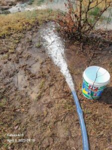
Estimating available groundwater quantity (water levels, flow rates, recharge rates).
Mapping and characterizing aquifers (types, permeability, porosity).
Analyzing groundwater quality (chemical and physical parameters).
Identifying risks such as contamination or over-extraction.
Using integrated methods like Electrical Resistivity Tomography (ERT), Ground Penetrating Radar (GPR), remote sensing, GIS, and hydrogeological data to get a comprehensive understanding.
Establishing monitoring frameworks for ongoing evaluation. The assessment results in detailed maps (e.g., groundwater potential, quality indices) and datasets, serving as the foundation for sustainable use planning.
 Groundwater Development and Management
Groundwater development plans are based on assessment findings and typically include:
Setting clear goals and objectives for resource use.
Strategies for sustainable extraction respecting safe yield limits.
Measures for groundwater recharge, contamination control, and ecosystem protection.
Stakeholder engagement for effective resource governance.
Monitoring and evaluation systems, including real-time monitoring tools.
Allocation of funding and resources for implementation. Sustainable management aims to prevent depletion and pollution, optimize recharge, and maintain ecological balance. Legal, institutional, and policy frameworks support these goals by defining rights, restrictions, and responsibilities.
Advanced techniques enhance subsurface understanding and assessment accuracy.
Advanced understanding groundwater systems, use of satellite imagery and geophysics to locate sources. Down hole and geologocal methoids to locate sustainable sources
Integration of various data sources and methods (Satelute imagery, geophysics, field measurements, lab tests, remote sensing, modeling) is critical.
Groundwater management frameworks include aquifer protection, quality management, remediation, wellfield planning, and operational maintenance.
Emphasis on adapted local management aligned with scientific support, funding, and institutional commitment.
Overall, groundwater assessment and management form a continuous cycle: assessment informs development plans, which guide management actions, monitored for adaptive responses to dynamic groundwater systems. This approach ensures long-term availability and protection of groundwater resources.