Have you ever pondered the secrets concealed beneath the earth's surface? Ground Penetrating Radar (GPR) offers a means to unveil these mysteries, enabling the creation of detailed images of subterranean structures. This advanced geophysical method produces high-resolution representations ouncovering concealed assets, conduits, cables, voids, geotechnical elements, among others, ranging from depths of one meter to exceeding thirty meters!
Ground Radar
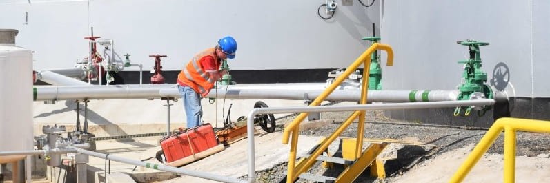
GPR Field surveys
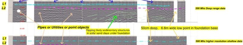
GPR Data
Ground Penetrating Radar (GPR) is celebrated for its exceptional capability to deliver accurate visualizations of the shallow subsurface, rendering it an indispensable instrument for a multitude of purposes, including Non-Destructive Testing (NDT) applications in construction and roading, utility location, and the detection of voids. Groundsearch is honored to boast an extensive history of successful GPR surveys, providing a solution that is both efficient and economical.