Finding reliable groundwater in rural Southeast Asia has traditionally meant drilling blind — expensive, uncertain, and often unsuccessful. Electrical Resistivity Tomography (ERT) has changed that. Here’s how we use it.
ERT passes small electrical currents through the ground using an array of electrodes laid out on the surface. By measuring how electrical resistivity varies with depth and distance, we produce a 2D or 3D image of the subsurface — like a geological X-ray.
Water-saturated soils and rock have lower electrical resistivity than dry material. Clay layers — which act as aquitards — have very low resistivity. Clean sand and gravel aquifers have distinctive resistivity signatures depending on their water content and salinity. By mapping these patterns, we can identify where aquifers exist, how deep they are, and whether they likely contain fresh water.
In Preah Vihear Province, previous drilling had consistently failed to find productive water at depths below 30m. Our ERT survey identified a zone of low-resistivity fractured granite at 45–60m depth along a previously unexplored structure. A borehole drilled at the geophysically-defined target found a productive aquifer — providing sustainable water supply for the community where previous investigations had failed.
ERT is not a replacement for a well — it is what makes your well succeed. Used before drilling, it typically reduces overall investigation costs and dramatically improves success rates.
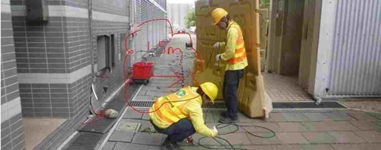
MASW (Multichannel Analysis of Surface Waves) is one of the most cost-effective tools available for geotechnical site characterisation — yet many engineers have never heard of it. Here’s what it does and when to use it.
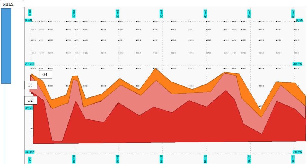
When you hit the ground with a sledgehammer, surface waves radiate outward. Different frequencies of those waves travel at different speeds depending on the stiffness of the soil — slower in soft material, faster in stiff or rocky ground. MASW records these waves using a line of geophones, then uses the frequency-velocity relationship to calculate shear-wave velocity with depth.
Shear-wave velocity (Vs) is a direct measure of soil stiffness. Engineers use it for seismic site classification (Vs30), settlement estimation, rippability assessment, and detection of soft or voided zones. Most importantly, MASW gives you a continuous profile along a survey line — not just at a single borehole.
Before a pipe jacking operation in Singapore, the design team needed to know where shallow rock would be encountered along the alignment. A Groundsearch MASW survey along the pipe jacking line identified depth to rock continuously — revealing two zones where bedrock was unexpectedly shallow, allowing TBM specification to be adjusted before excavation.
MASW gives geotechnical teams a tool that bridges the gap between scattered boreholes — revealing the full picture of site variability at a fraction of the drilling cost.

Most construction projects begin with borehole drilling. But drilling gives you information at a single point — not across the whole site. Here are five situations where a geophysical survey should come first.
Old mine workings, former industrial use, filled land, or known sinkhole-prone geology are situations where knowing what is between the boreholes matters as much as what is in them. ERT and GPR surveys can map these hazards across the entire site.
Roads, pipelines, railway lines, and canals pass through variable geology. MASW seismic and ERT surveys provide continuous profiles along the alignment — catching zones of weak soil, shallow rock, or groundwater that isolated boreholes would miss.
If two boreholes 50m apart show completely different soil profiles, you have lateral variability you do not understand. A geophysical survey between the boreholes resolves what is happening — and tells you whether to drill more or whether you already have enough information.
Borehole drilling has a very small chance of intersecting a cavity — GPR and ERT surveys cover large areas and are specifically designed to detect subsurface voids before they cause foundation problems or pavement collapses.
Any excavation below the groundwater table needs groundwater information. ERT can map the water table, identify permeable and impermeable layers, and flag zones of high groundwater that will affect dewatering design and cost.
Geophysical surveys do not replace boreholes — they make your boreholes more effective and your site characterisation more complete.
